
Koloa Field System
June 26, 2012The archaeological team began the day with a tour through the Koloa field system guided by Dr. Hal Hammatt of Cultural Surveys Hawaii. The Koloa field system comprises the remainder of what was once an extensive complex of irrigated pond fields (loi), habitation sites, and heiaus. We walked the irrigation system while referencing an archaeological survey map created prior to large-scale development in the area (see photos). Imaging was recorded for large portions of the complex using Chuck’s kite and Dave’s fixed-wing. Aerial photographs will be posted as they become available.
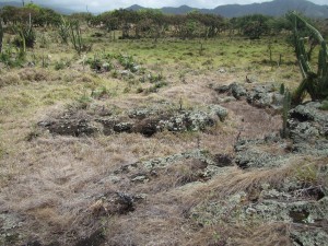

The extent of Hawaiian agricultural investment in drier areas such as Koloa was made possible through the use of intricate irrigation systems. The full range of these systems can be captured from high elevation photography and multispectral applications. The KAP and fixed-wing approaches were successful today. Documentation of these archaeological features will continue throughout the week with other airborne remote-sensing platforms.
– John Thornton O’Connor