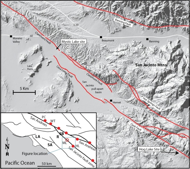
Active tectonics of the San Jacinto Fault and interaction with the San Andreas fault

Northern San Jacinto Slip Rate:
Using a combination of field mapping, analysis of B4 LiDAR data, geochronology, and trenching we have documented the Quaternary slip-rate and slip-per-event over the past 200 years from the Quincy site. We found that slip rates on the northern San Jacinto are equal to or higher than on the adjacent segment of the San Andreas fault, and that the slip rate has varied over the past 2000 years, most likely due to variations in earthquake size and clustering of earthquakes in time.
Northern San Jacinto Paleoseismology:
At the Mystic Lake site we have documented 16 pre-historic earthquakes in the upper 5m (~3700 yBP). The mean recurrence interval for the past 2000 years is 160 years, with the most recent event occurring around AD 1800 (possibly the AD 1812 event that also ruptured the San Andreas fault).
All of this work has been done in collaboration with Sally McGill (CSUSB), Tom Rockwell (SDSU) and numerous students and Southern California Earthquake Center interns. See our papers on the publications page for more info. This work has been funded by SCEC and an EHP grant from the USGS.
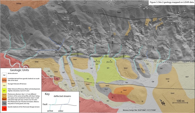
Geologic map of the Quincy site showing fault strands in black
Current Work: The Cajon Pass “earthquake gate”- what controls rupture patterns in the area where the San Andreas, San Jacinto, and Transverse Ranges reverse faults interact?
We have now turned our attention to the northernmost end of the San Jacinto where it splits into three main strands in the Cajon Pass area. Work in progress is focused on determining the recency of faulting and Holocene activity on these three strands to figure out which strands are the main locus of slip, and how slip might be transferring between the San Jacinto and San Andreas faults. We are currently mapping the geomorphic evidence of recent movement on the fault strands and evaluating potential sites for future slip rate and paleoseismic work.