GATEWAY CITIES
General Plan Update 2000

Welcome to the Gateway Cities General Plan Update 2000.
This map and its associated digital files together
are an attempt to disseminate the most recent information available for
regional planning purposes -- and in GIS-compatible form.
This update to the SCAG Access Project General Plan
Map is on this CD-ROM as an ArcView GIS Project [GP2000.apr].
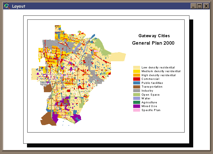
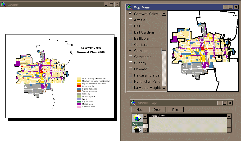
The opening screen shows an ArcView "LAYOUT" window
which can be used to compose presentation quality maps.
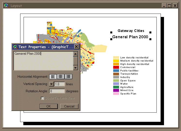
The text can be changed and moved on the page by simply
selecting the text item to modify.
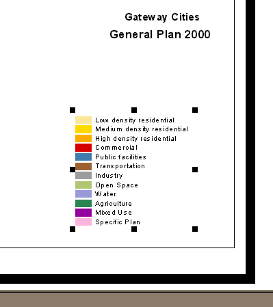
The Legend which appears on the Layout page is actually
a set of graphic symbols and text which have been grouped together.
It can be sized or moved just like all elements of the Layout.
The Layout may be enhanced by adding a scale (all map
units are in State Plane NAD 83), north arrow and additional text.
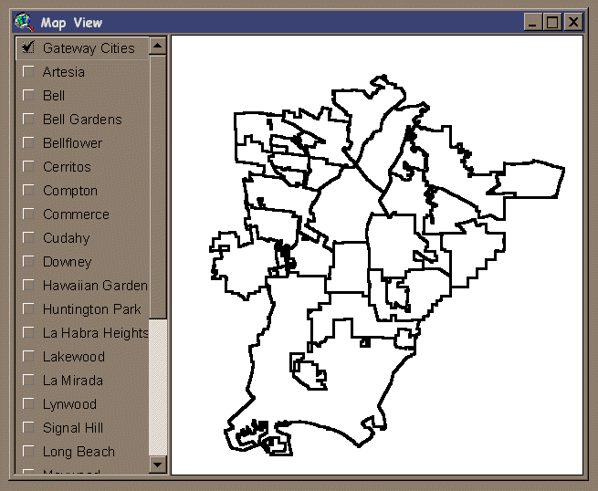
Another window in the project is the Map View.
This window allows complete interactive view and query of the map components
-- the members of the Gateway Cities Council of Goverments. The detailed
land use areas of each jurisdiction can be either "turned on or turned
off" by checking the box next to the city name.
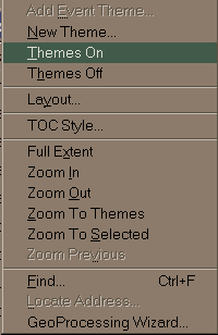
From the View Menu, the Themes
On and Themes Off items can be used to turn all the city
maps on or off at the same time.
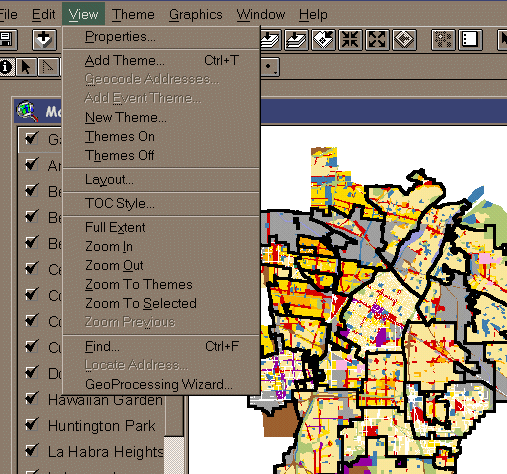
Just Highlight the appropriate action item.
.
We can choose to view a subset of the Gateway Cities by turning
on only one or more individual cities -- in this case the City of Lakewood.
And by using the Zoom to Active Theme button, we can zoom into the Lakewood
area.
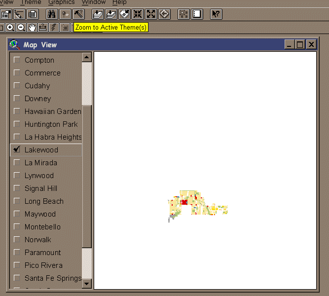
We can even zoom in further by using the Zoom Tool and
drawing a zoom-box with the cursor.
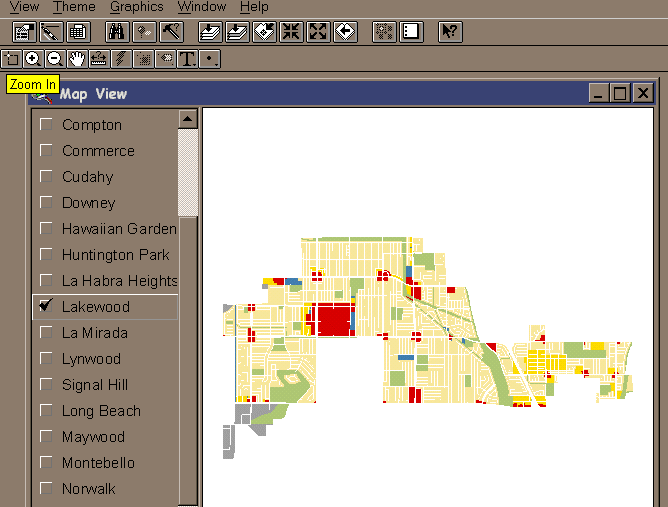
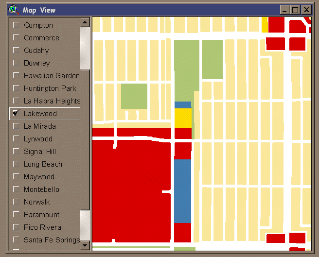
Here you can see the level of detail available from those
cities that have implemented Geographic Information Systems locally.
Here the City of Lakewood has provided General Plan data at the parcel
level -- with an extremely accurate basemap. For our COG General
Plan, those parcels have been "dissolved" into general plan polygons for
both practical and legal reasons.
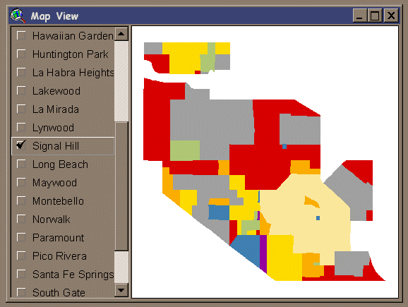
Signal Hill does not have a digital mapping system but provided
hard copy maps of the city. We used these data to update and correct
the original land use categories in the ACCESS Project maps.
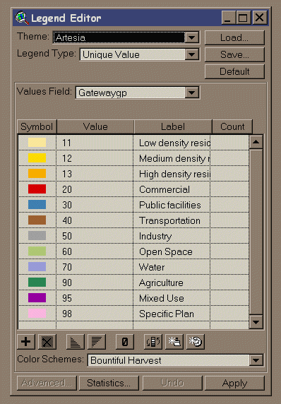
In all cases, the Legend categories are the same -- generalized
from those of the individual COG members to a level of detail appropriate
for regional planning purposes.
The numeric codes used for the Gateway GP Categories and
their descriptive equivalents are shown here (as they are in each theme
legend).
Inconsistencies abound within the region, however, and
what qualifies as "Medium Density Residential" for one jurisdiction may
fall into another for another city or the region. You are encouraged
to look at the Excel Spreadsheet on the CD for an attempt to compile the
range of definitions used in residential land use categories amongst the
member cities.
The GP2000.apr project contains digital files for each
member of the COG in ArcView Shapefile format. Each
city was asked to provide the latest General Plan information possible
for their area and were given the opportunity to review the draft General
Plan Map for their jurisdiction. Data
quality varies a great deal from cities with extremely precise locations
with quality checked attribute data to those which sent data in B/W map
form with little explanation. (And some jurisdictions did not participate
at all -- in which case the original SCAG ACCESS data were used by default.)
Obviously those cities who are actively involved in building
and maintaining GIS mapping capabilities within their organizations were
able to provide high-quality data in a timely manner. Hopefully the
next update will see an even greater number of organizations using
this technology.
A Current Version of this Web Page and other Update Information
can be found at
http://www.csulb.edu/~gossette/gateway
For Additional Information Contact:
Dr. Frank Gossette
Professor of Geography
California State University, Long Beach


