
LIDAR image analysis
July 6, 2012Hello,
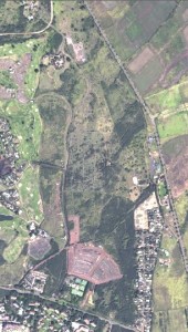
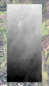
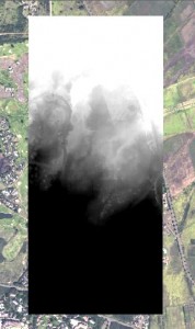
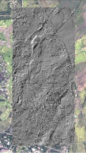
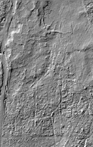
We obtained the LIDAR data for our focus area of the Koloa field system. Manipulating the histogram parameters creates workable imagery showing pre-contact habitation platforms and agricultural fields in a well-defined medium. Hillshade digital elevation models were constructed based on this information. The resulting hillshades are helpful in revealing anomalies in natural terrain. Areas of anthropogenic modification are readily apparent contributing to the identification of archaeological features in a region where much of the prehistoric landscape has been hidden by modern land use. Below is a series of images displaying 1) area of interest 2) LIDAR data 3) manipulation of LIDAR imagery for improved resolution 4) hillshade effect over area of interest 5) subset of modified LIDAR image delineating archaeological features and 6) subset of hillshade layer where platforms and filed boundaries are visible.
Academic posters will be printed Friday afternoon and student presentations will begin Saturday morning. Summaries of individual research projects will be posted to student project pages accessible through the corresponding group project page.
– John Thornton O’Connor