
Hexacopters, Kites, and more GIS
June 28, 2012Aloha,
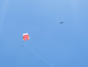
I spent much of this morning with Dr. Lipo calibrating and testing the hexacopter. The professor had installed a new motor and several adjustments had to be made in order for the unit to function properly. We will be attaching two GoPro cmaeras, one with color-infrared modification, for aerial stereoscopic imagery. Once the aerial equipment was operating, our archaeological research team spent time coordinating our work. The nature of our specific research interests has resulted in complementary projects. We will be giving an “in-progress” presentation on our research tomorrow. General outlines of our projects can be found at Projects->Prehistoric Agricultural Fields on the main page of the NSF REU site. The afternoon was spent in the field flying an alternate kite rig. The kite design itself appeared a more stable substitute to the previously employed kite unit. However, the line and rig was not modified to exploit the dynamic wind conditions and our line broke shortly after lift-off. The kite and cameras were recovered and will be used with a stronger set-up later in the week. Check out this photo of an iwa courting our research kite.
This evening, imagery was reviewed and compiled for presentation. I played around with digital elevation models but was not able to achieve the results I expected. I did succeed in finding multispectral band mixes that helped to visualize basalt features from Worldview satellite data. I will be exploring LIDAR information later in the week and comparing these classes of data for the revelation of obscured archaeological structures.
– John Thornton O’Connor