
Georeferencing
July 2, 2012Good evening,
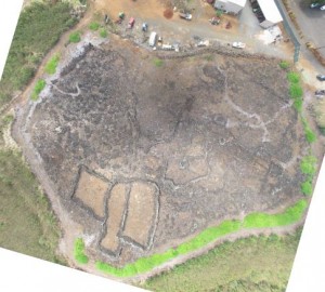
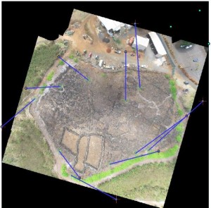
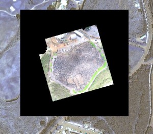
This morning began a long week of data processing. I began the day with orthophoto creation from KAP and UAV data of Koloa archaeological preserve 1. True-color and near-infrared mosaic images were constructed primarily through the use of Agisoft Photoscan. The images were then georeferenced, that is tied into coordinates determined by global positioning systems points taken while in the field. This is a relatively simple though time consuming process. Georeferencing defines the spatial dimensions of an image by giving it place in the world. I had previously completed georeferenceing exercises using ERDAS (see my first post). Today, Lawrence and I georeferenced the preserve 1 images in ArcMAP 10 and overlayed the orthophotos on a Worldview multispectral image. Successive images illustrating the process of GPS point association are displayed below.
The same process was completed for images in multiple images of various spectral bands. Orthophotos are currently being processed for a major portion of the existing Koloa agricultural field system. These images will be georeferenced tomorrow along with corresponding LiDaR DEMs. Much work ahead. Very exciting!
– John Thornton O’Connor