
Data processing…
June 30, 2012Howzit,
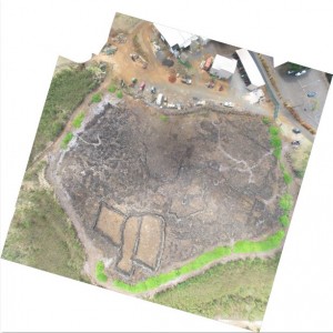
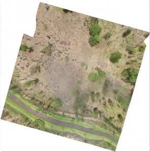
Remote-sensing information acquisition has ceased. Data processing has been ongoing throughout the duration of this program, but efforts will be stepped up over the next several days. I will be compiling aerial photographs for portions of the Koloa field system as part of an imagery collection for Teddy Blake. Today, I created lower quality orthophotos for the “preserve 1” area and certain agricultural sections documented with fixed-wing remote controlled aircraft and KAP. I will begin to recreate these images in higher resolution for detailed analysis and then georeference the images into a comprehensive GIS for cultural preservation and scientific research purposes. Below are images of “preserve 1” and a small portion of the field system. The problems inherent in the field image are immediately apparent and will have to be corrected in successive photo compilations.
Data processing will continue until the completion of the GRAM program next week. I will hopefully have exciting imaging to post each day. Please check back soon.
– John Thornton O’Connor