
Crash course in ERDAS
June 12, 2012Howzit,
Tuesday morning began with a class session on scientific theory and the necessity of falsifiable hypotheses for the generation of knowledge. Dr. Lipo provided an excellent lecture on the value of science and problem oriented research as a prerequisite to our discussion of remote sensing techniques. Research questions will always dictate technique selection and these problems must be approached through sound scientific theory. After lunch, Dr. Lee presented a thorough introduction to remote sensing concepts and various technical applications citing the interplay of spatial, spectral, and temporal resolution available with different data acquisition methods. Background information was discussed regarding the particular methodologies to be employed during the field portion of this program.
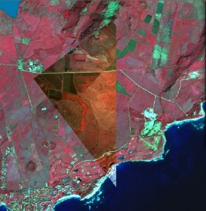
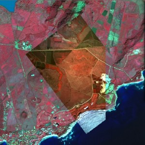
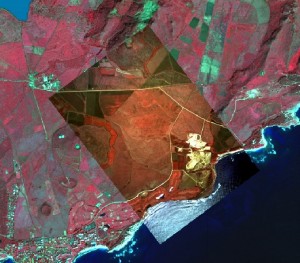
Dr. Lee’s lecture was followed by my first introduction to ERDAS as taught by Mike, a graduate student and GIS specialist here at CSULB. My interest in georeferencing overcame my lack of familiarity with the program and I was successful in the image-to-image rectification of visual data for an area of Mahaulepu, Kauai. The following pictures display a real-color photograph from NASA Pathfinder that has been georectified to a 8-band mutispectral Quickbird image of the same region.
I look forward to successive lab exercises with ERDAS and ArcGIS as preparation for next week’s fieldwork. That’s all for now.
– John Thornton O’Connor